Page created July 2009.
Funding provided by Risk Prediction Initiative (RPI) of the Bermuda Institute of Oceanic Sciences (BIOS),
and the Florida Catastrophic Risk Managment Center.
Last updated: Wed Jul 15 21:37:12 UTC 2026
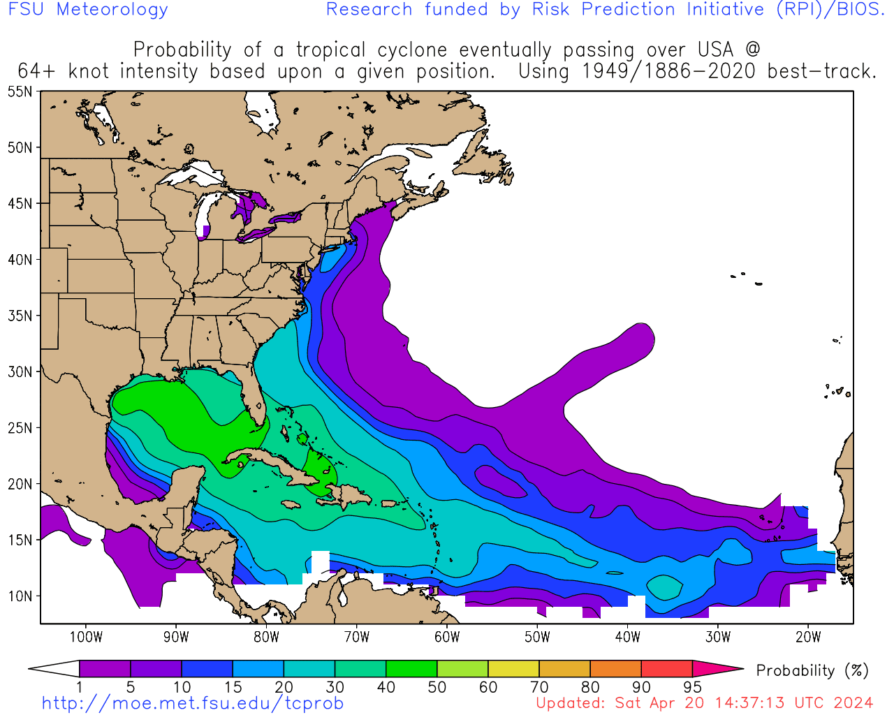
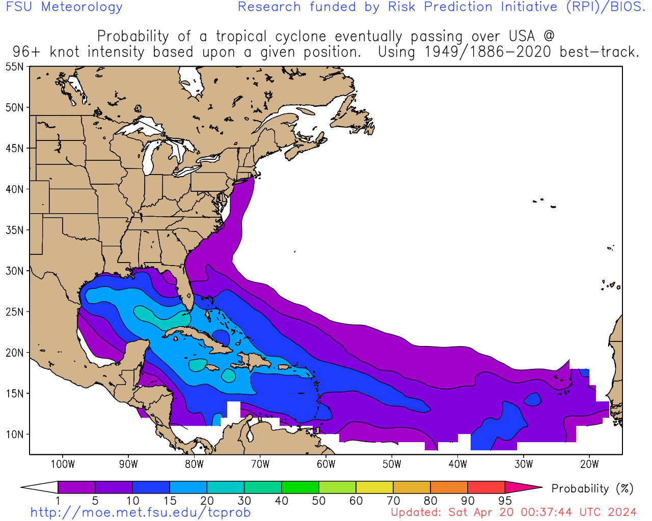
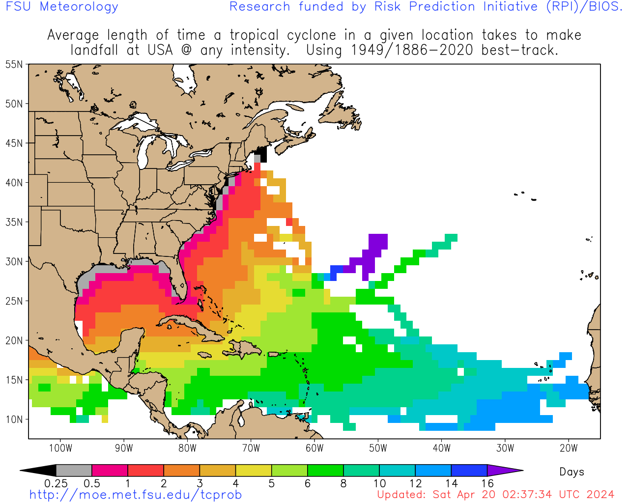
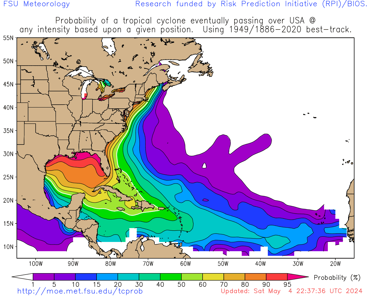
Climatologically most likely landfall region(s) for current storms, and
mean time from latest position to that landfall if it were to occur*:
| Rank | Any Intensity | Hurricane Intensity | Hurricane Intensity |
*Important note: These statistics ignore completely the current intensity or motion of the storm
and are based solely on a climatology based on the current position. They are prone to large forecast error.
Users should use only official forecasts for decisions, such as those provided by NHC, JTWC, and CHC.