Back to Main Page
Jump to a different period:
[ 1950s| 1960s| 1970s| 1980s| 1990s| 1997| 1998| 1999| 2000| 2001| 2002| 2003| 2004| 2005| 2006| 2007| 2008| 2009| 2010| 2011| 2012| 2013| 2014| 2015| 2016| 2017| 2018| 2019| 2020| 2021]
| 2003 |
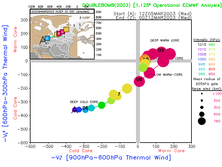
6-12 March |
Double Bomb |
North Atlantic |
Extratropical cyclone that undergoes two periods of extremely rapid intensification, leading to a warm seclusion of astonishing intensity. Minimum pressure of 924hPa with a drop of 55hPa in 24hr. Deepest Atlantic non-tropical low since Faeroe Island low of 1993 (916hPa).
|
EC OPER:
Image
Anim
|
EC OPER:
Image
Anim
|
2003 |
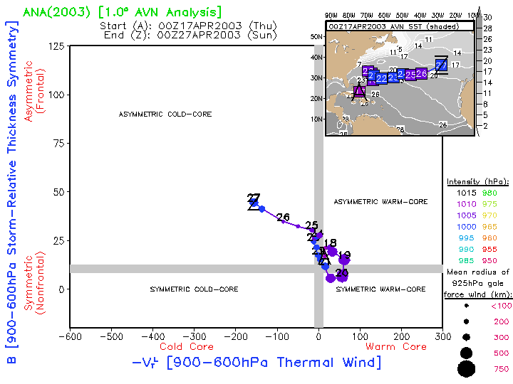
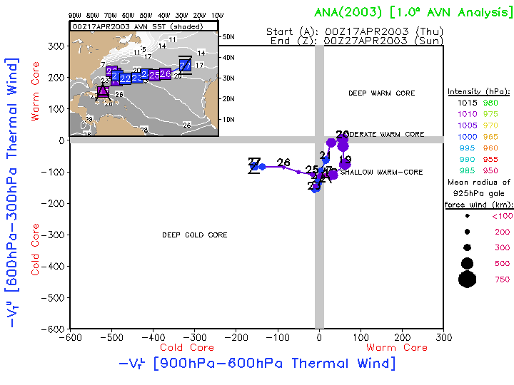
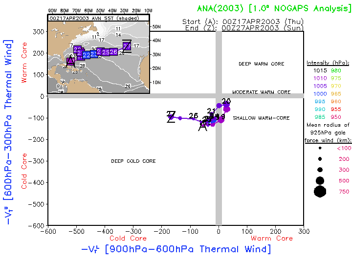
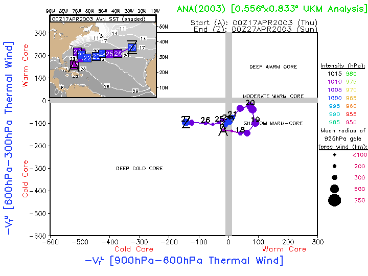
16-27 April |
Subtropical Storm Ana |
North Atlantic |
Extremely early conversion of a cold-core cyclone to a subtropical cyclone, and then back to an extratropical cyclone before merging with a larger north Atlantic cold-core cyclone.
|
AVN:
Image
Anim
|
NOGAPS: Image Anim UKMET: Image Anim
AVN:
Image
Anim
|
NOGAPS: Image Anim UKMET: Image Anim 2003 |
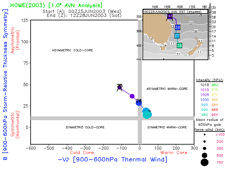
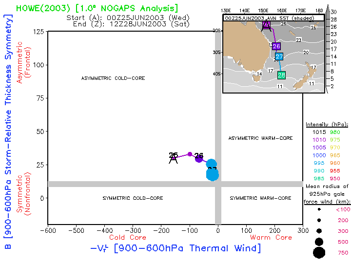
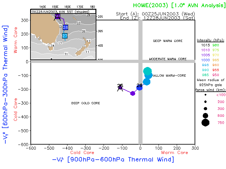
25- June |
Subtropical(?) Cyclone |
South Pacific |
Weak cold-core cyclone that underwent rapid development, possibly acquiring subtropical structure in the process. |
AVN:
Image
Anim
|
NOGAPS: Image Anim
AVN:
Image
Anim
|
NOGAPS: Image Anim 2003 |
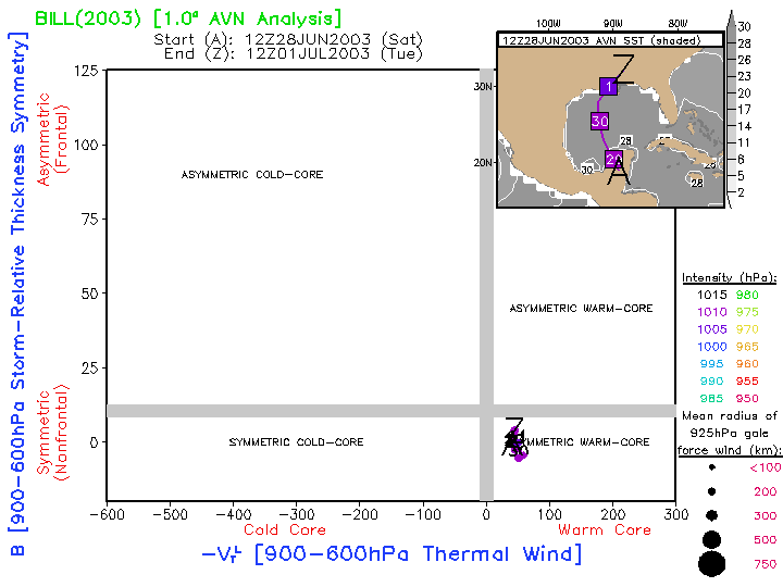
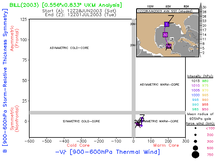
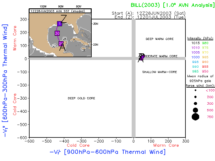
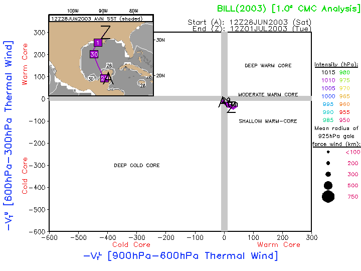
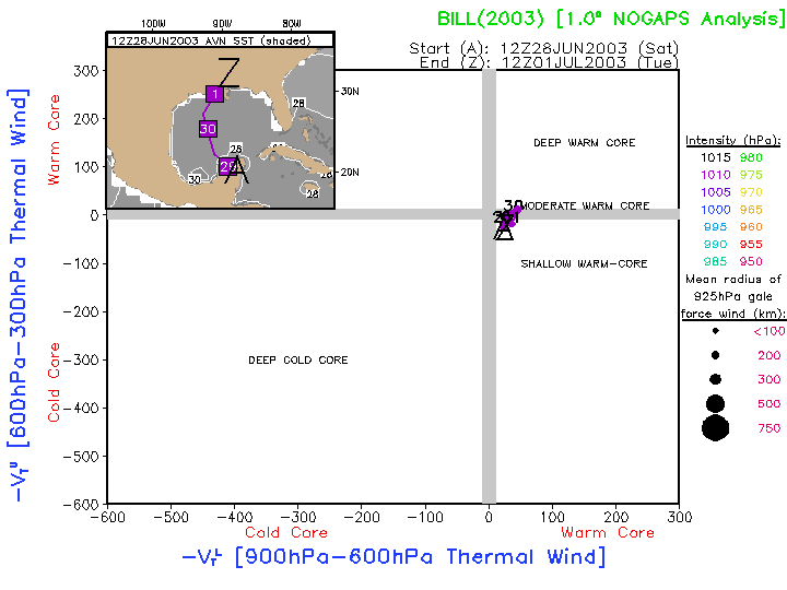
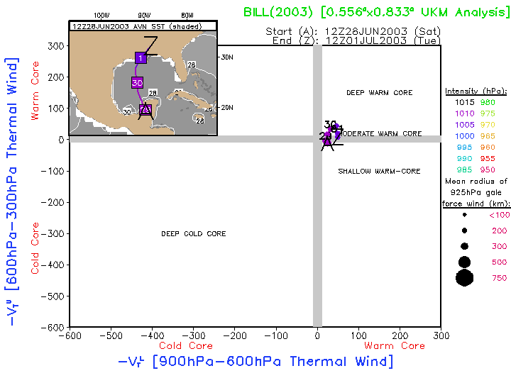
28- June |
Tropical Storm Bill |
North Atlantic |
|
AVN:
Image
Anim
|
CMC: Image Anim NOGAPS: Image Anim UKMET: Image Anim
AVN:
Image
Anim
|
CMC: Image Anim NOGAPS: Image Anim UKMET: Image Anim 2003 |
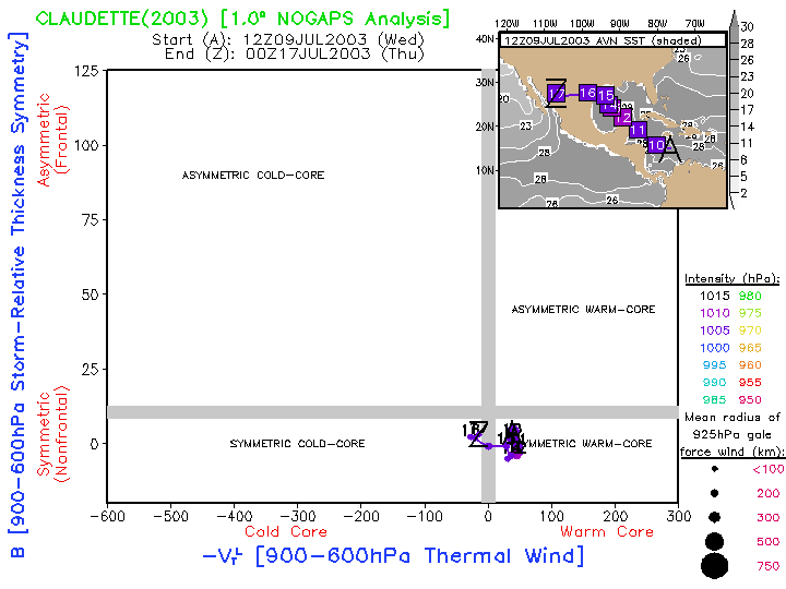
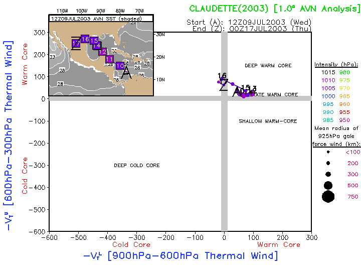
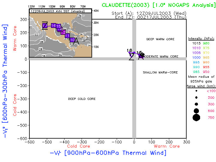
9-17 July |
Hurricane Claudette |
North Atlantic |
|
AVN:
Image
Anim
|
NOGAPS: Image Anim
AVN:
Image
Anim
|
NOGAPS: Image Anim 2003 |
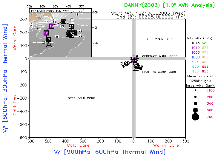
16-25 July |
Tropical Storm Danny |
North Atlantic |
|
AVN:
Image
Anim
|
AVN:
Image
Anim
|
2003 |
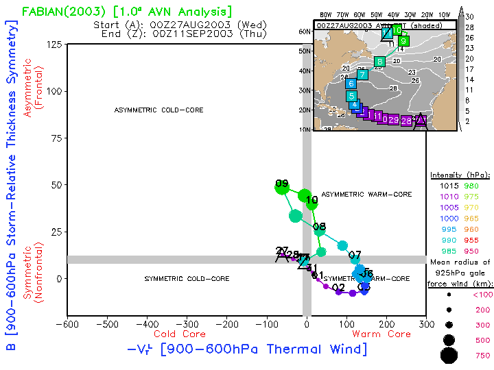
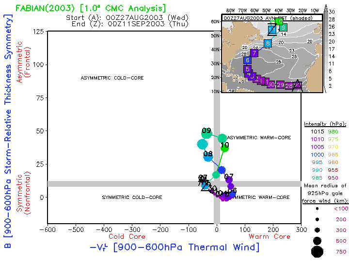
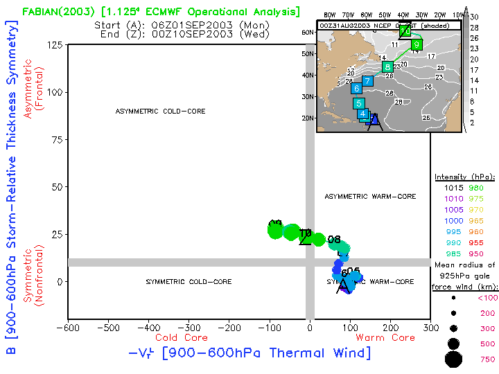
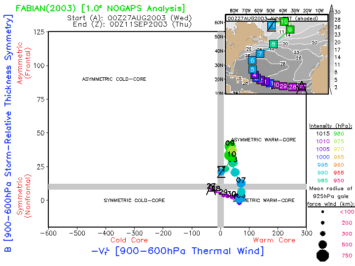
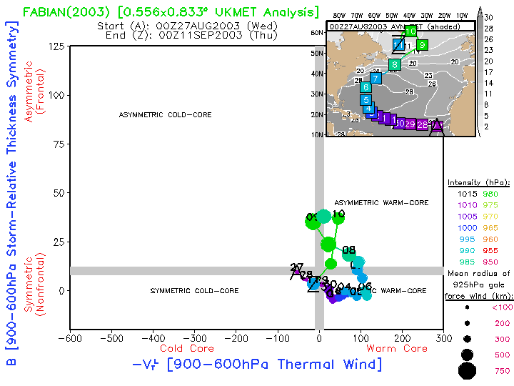
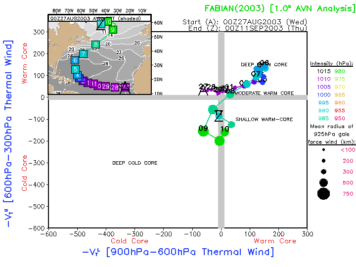
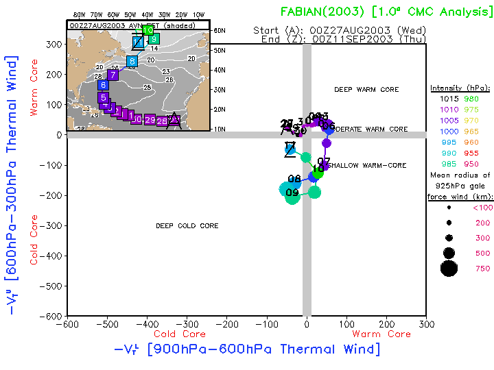
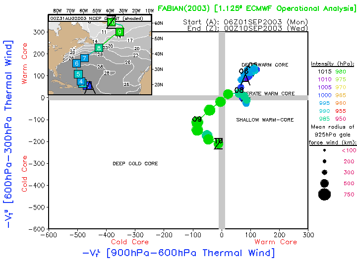
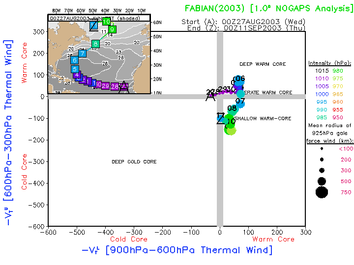
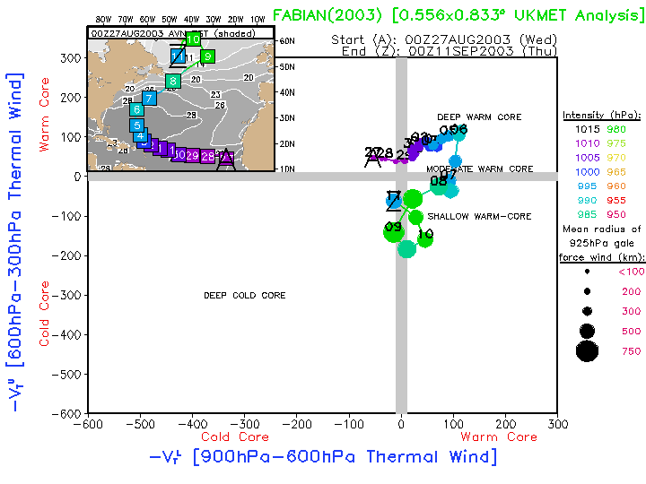
27 August- |
11 September Hurricane Fabian |
North Atlantic |
Extratropical transition of an intense hurricane into an intense extratropical storm.
|
AVN:
Image
Anim
|
CMC: Image Anim EC OPER: Image Anim NOGAPS: Image Anim UKMET: Image Anim
AVN:
Image
Anim
|
CMC: Image Anim EC OPER: Image Anim NOGAPS: Image Anim UKMET: Image Anim 2003 |
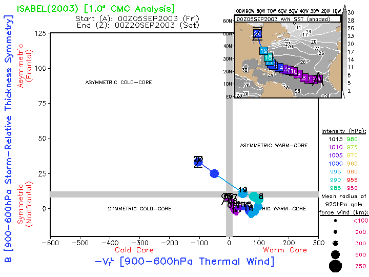
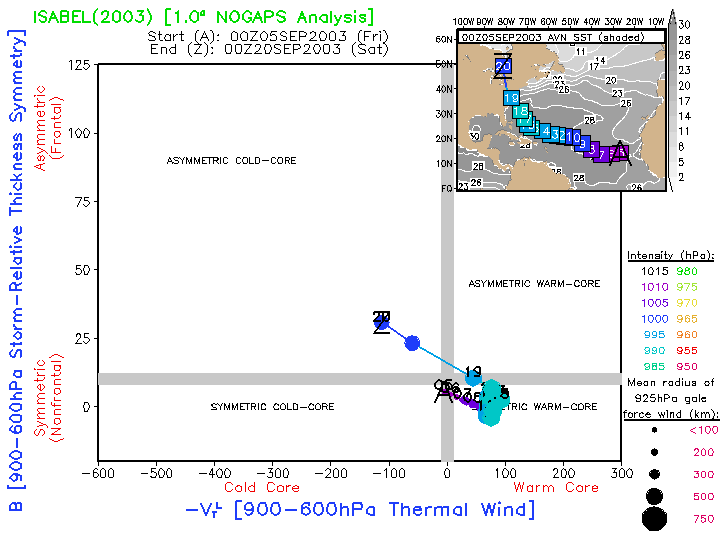
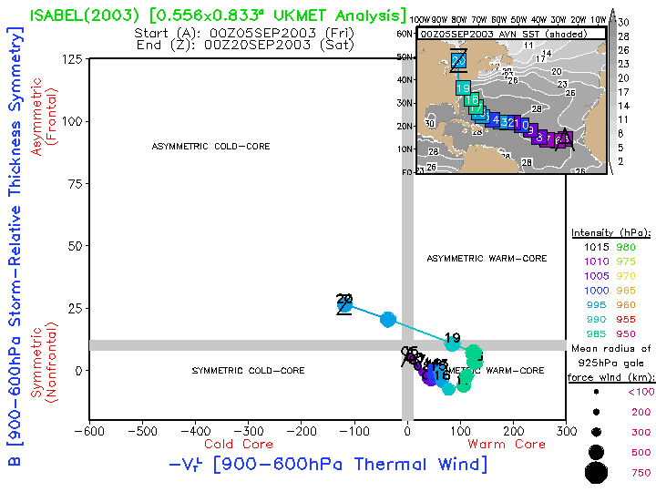
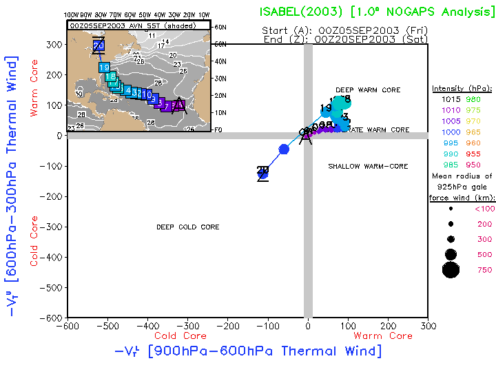
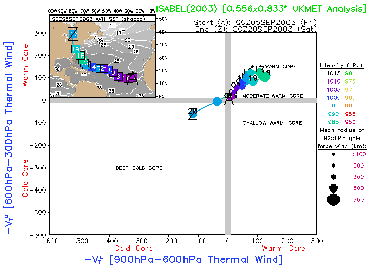
3-20 September |
Hurricane Isabel |
North Atlantic |
Category 5 hurricane that weakened to 1 or 2 before landfall, and
eventually underwent extratropical transition in Canada -- but not
before weakening greatly.
|
AVN:
Image
Anim
|
CMC: Image Anim NOGAPS: Image Anim UKMET: Image Anim
AVN:
Image
Anim
|
CMC: Image Anim NOGAPS: Image Anim UKMET: Image Anim 2003 |
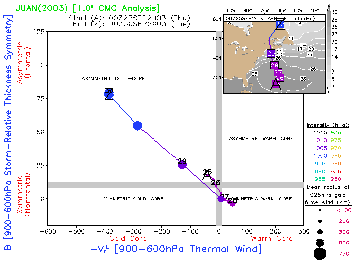
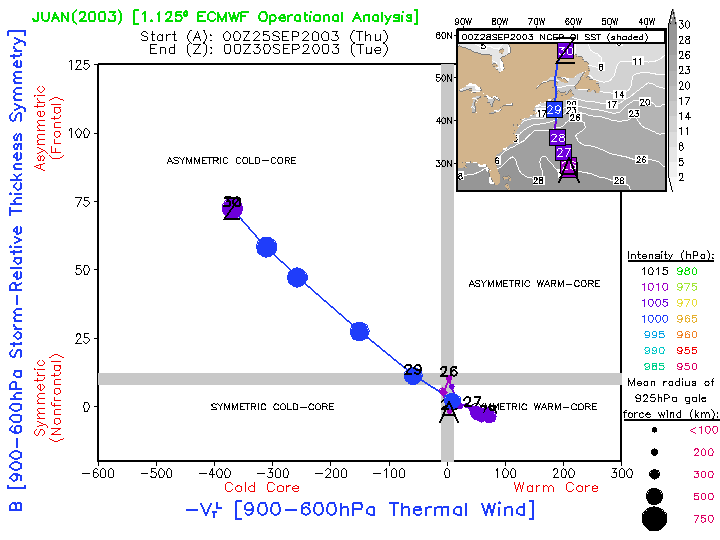
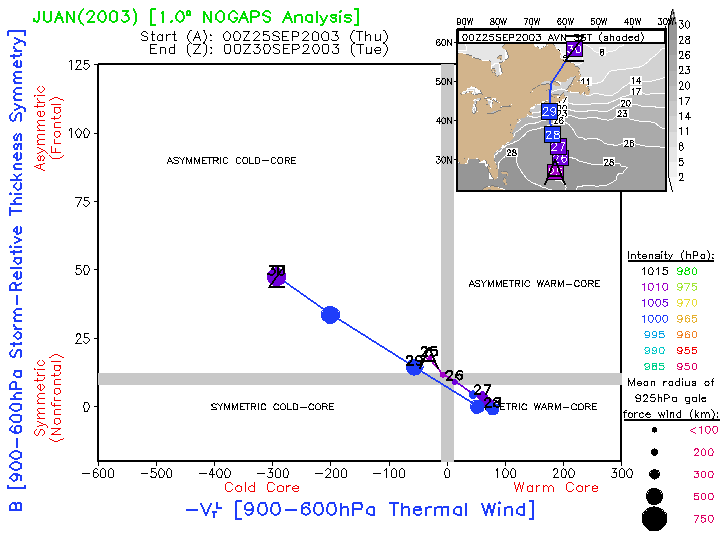
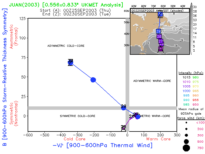
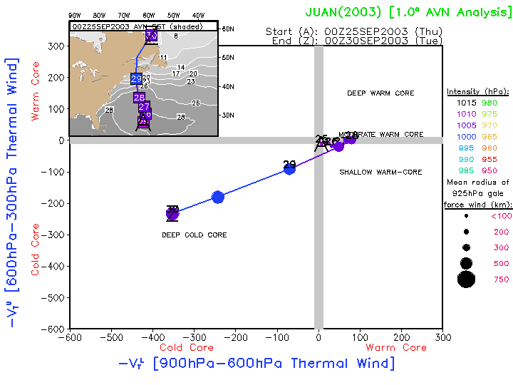
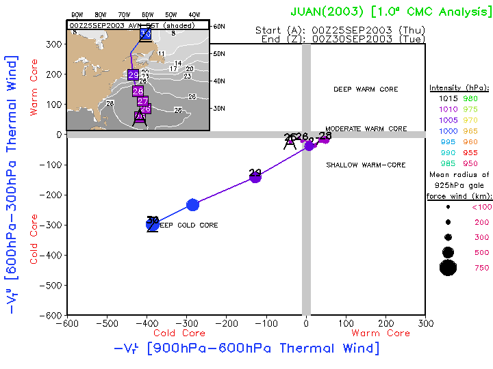
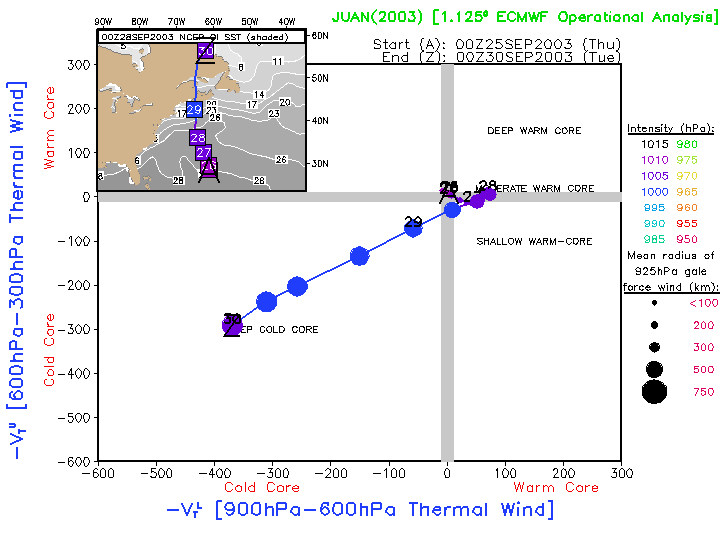
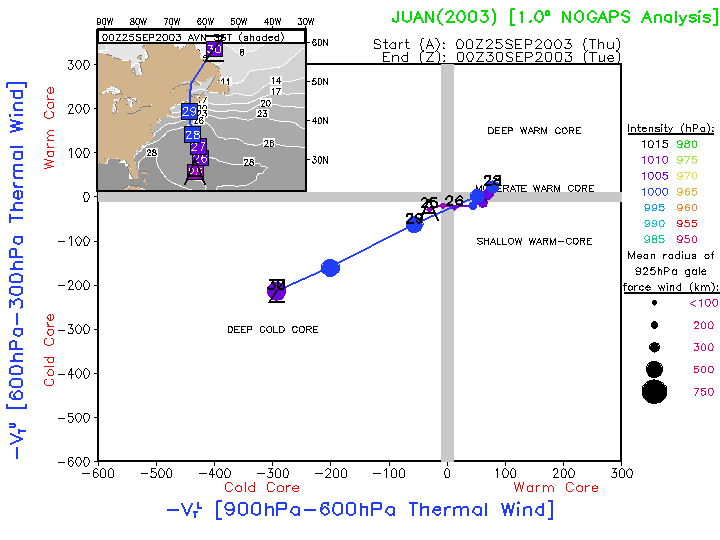
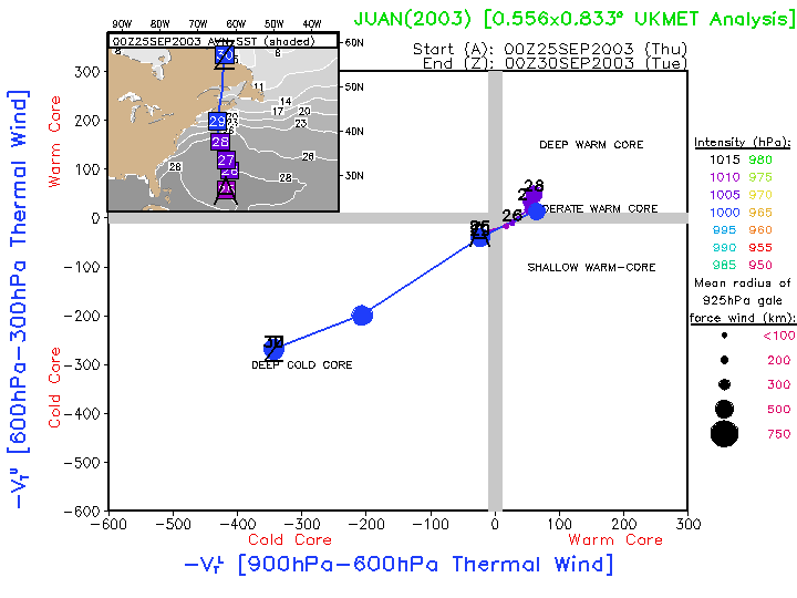
25-30 September |
Hurricane Juan |
North Atlantic |
Category 2 hurricane that was undergoing rapid extratropical transition
as it was making landfall very near Halifax.
|
AVN:
Image
Anim
|
CMC: Image Anim EC OPER: Image Anim NOGAPS: Image Anim UKMET: Image Anim
AVN:
Image
Anim
|
CMC: Image Anim EC OPER: Image Anim NOGAPS: Image Anim UKMET: Image Anim 2003 |
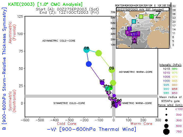
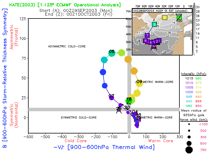
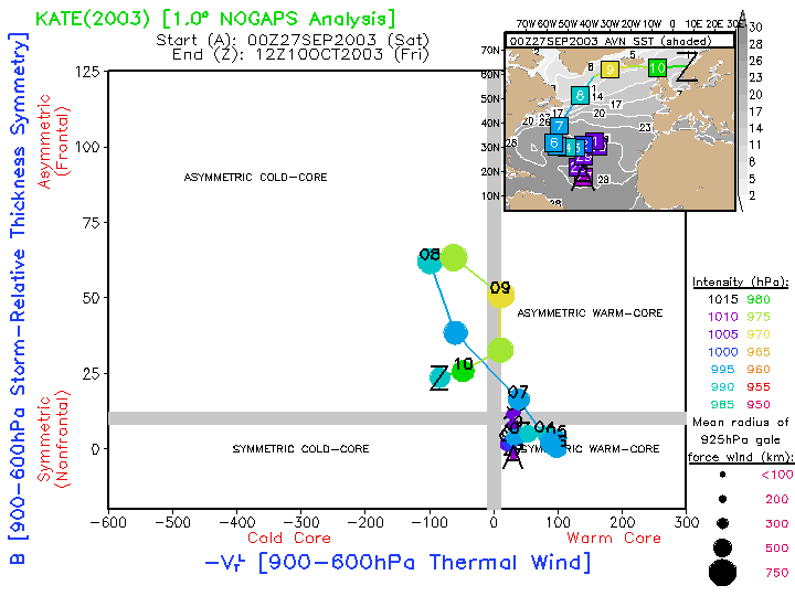
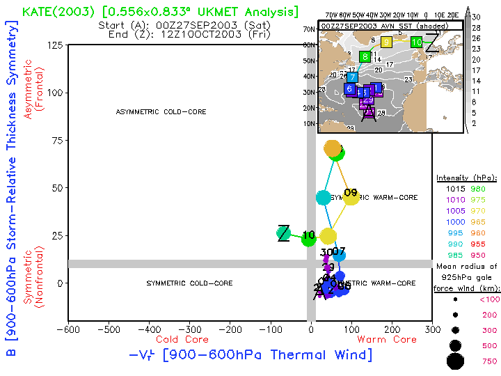
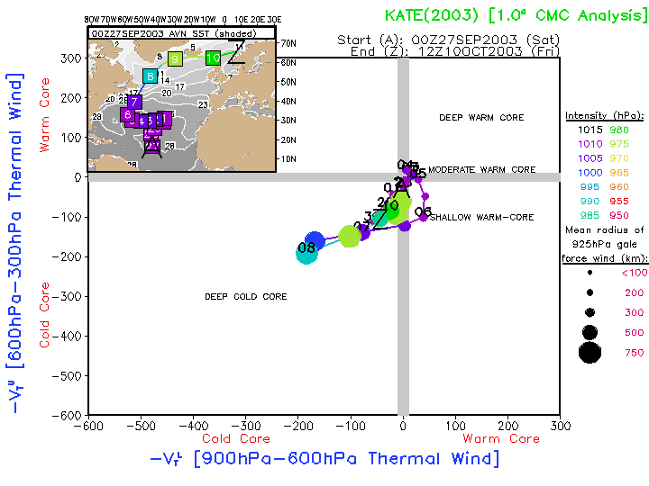
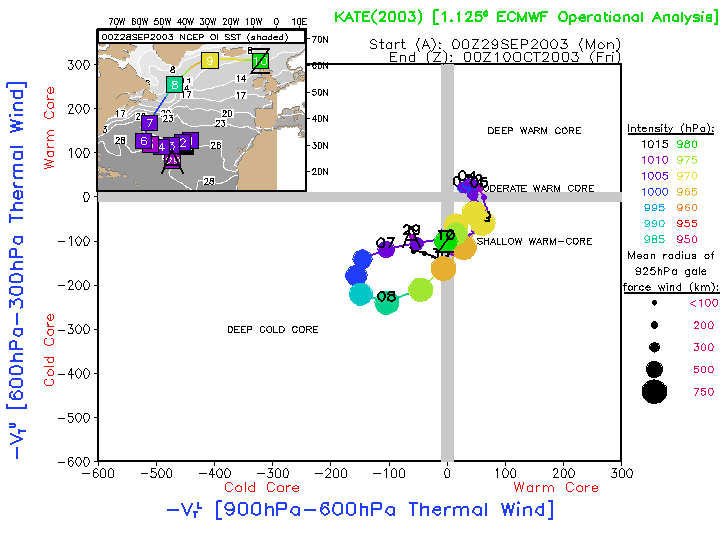
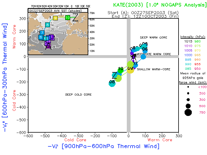
27 September- |
10 October Hurricane Kate |
North Atlantic |
Tropical storm that began extratropical transition, but then moved back over warm-water
reversing the transition, and eventually became a category 3 hurricane. Later underwent extratropical transition
east of NewFoundland, followed by deep warm-seclusion development, ending with transition back to cold-core and dissipation over Europe.
|
AVN:
Image
Anim
|
CMC: Image Anim EC OPER: Image Anim NOGAPS: Image Anim UKMET: Image Anim
AVN:
Image
Anim
|
CMC: Image Anim EC OPER: Image Anim NOGAPS: Image Anim UKMET: Image Anim |