Back to Main Page
Jump to a different period:
[ 1950s| 1960s| 1970s| 1980s| 1990s| 1997| 1998| 1999| 2000| 2001| 2002| 2003| 2004| 2005| 2006| 2007| 2008| 2009| 2010| 2011| 2012| 2013| 2014| 2015| 2016| 2017| 2018| 2019| 2020| 2021]
| 1990 | 24 July- 5 August |
Hurricane Bertha | North Atlantic | Example of a cold-core cyclone developing warm core structure (into a hurricane) -- "tropical transition" of an extratropical cyclone. | ECMWF: Image Anim | ECMWF: Image Anim |
| 1990 | 3-14 August | Tropical Storm Edouard | North Atlantic | . | ECMWF: Image Anim | ECMWF: Image Anim |
| 1990 | 27 August- 7 September |
Hurricane Gustav | North Atlantic | . | ECMWF: Image Anim | ECMWF: Image Anim |
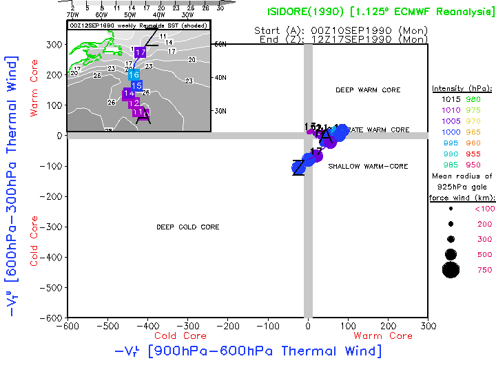
| 1990 | 10-17 September | Hurricane Isidore | North Atlantic | . | ECMWF: Image Anim | ECMWF: Image Anim |
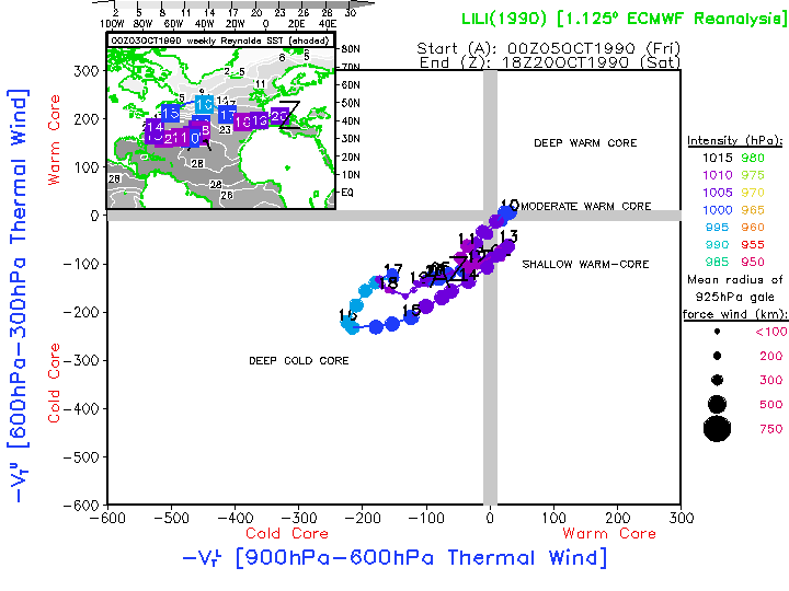
| 1990 | 5-20 Octobe | Hurricane Lili | North Atlantic | . | ECMWF: Image Anim | ECMWF: Image Anim |
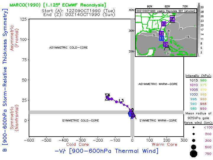
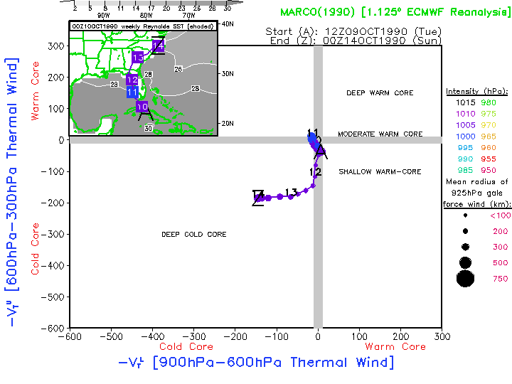
| 1990 | 9-14 October | Tropical Storm Marco | North Atlantic | . | ECMWF: Image Anim | ECMWF: Image Anim |
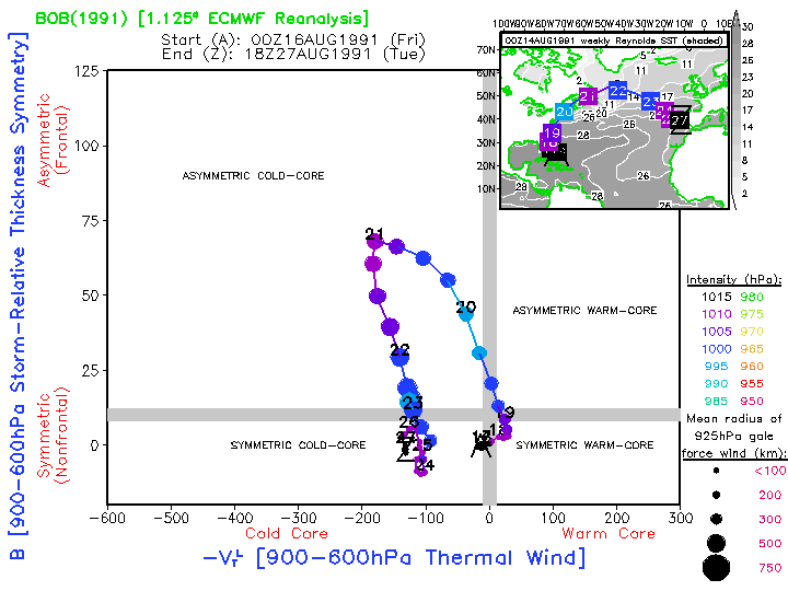
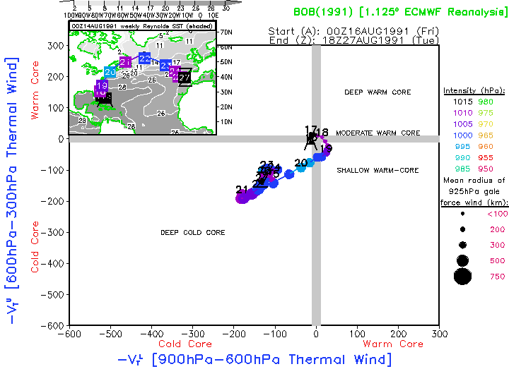
| 1991 | 16-27 August | Hurricane Bob | North Atlantic | Small but intense hurricane whose warm-core structure is greatly underestimated. Extratropical transition is diagnosed 18-24hr too early since the warm-core structure is poorly resolved. | ECMWF: Image Anim | ECMWF: Image Anim |
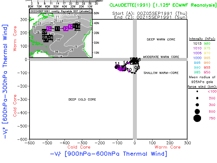
| 1991 | 5-15 September | Hurricane Claudette | North Atlantic | Category 4 hurricane whose necessarily strong warm-core structure is completely unresolved by these gridded analyses. | ECMWF: Image Anim | ECMWF: Image Anim |
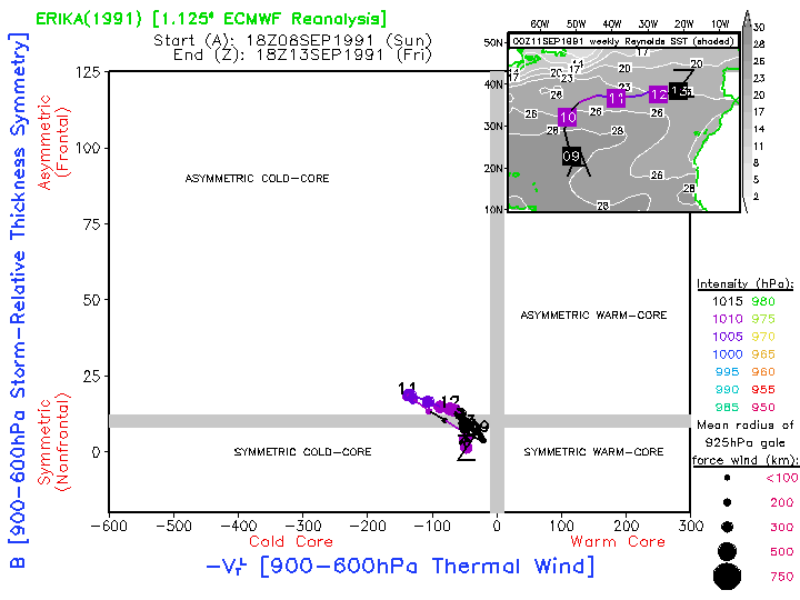
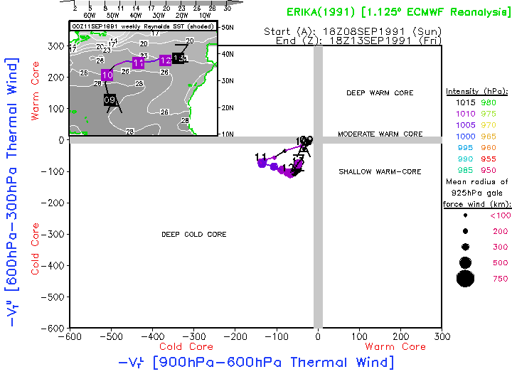
| 1991 | 8-13 September | Tropical Storm Erika | North Atlantic | Another example of the complete lack of a warm-core structure within the analyzed TC. Does not represent the TC evolution realistically. | ECMWF: Image Anim | ECMWF: Image Anim |
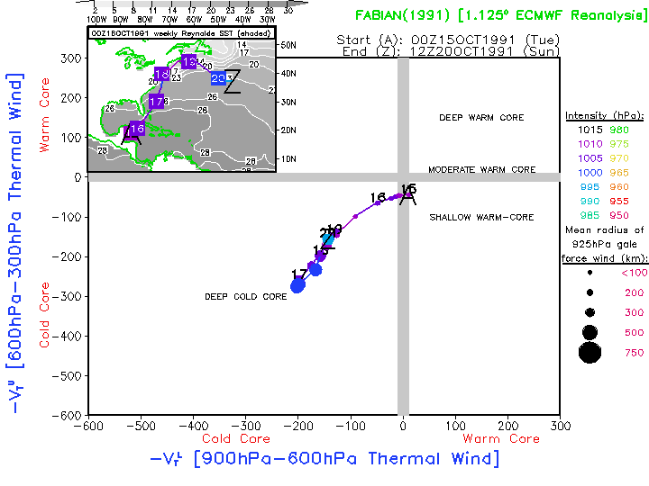
| 1991 | 15-20 October | Tropical Storm Fabian | North Atlantic | . | ECMWF: Image Anim | ECMWF: Image Anim |
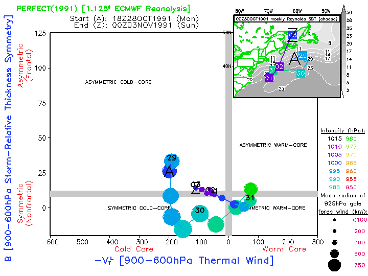
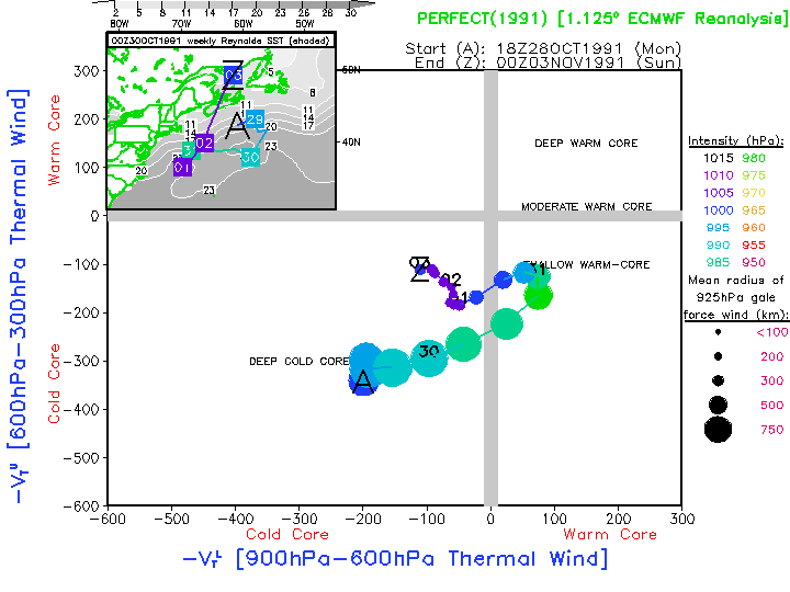
| 1991 | 28 October- 3 November |
Halloween "Perfect" Storm | North Atlantic | Cold core cyclone that absorbs Hurricane Grace, moves over Gulf Stream, and develops warm-core structure. | ECMWF: Image Anim | ECMWF: Image Anim |
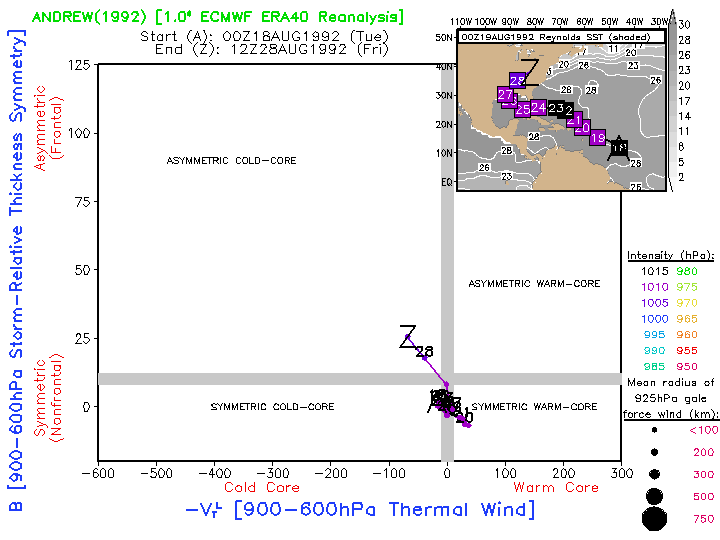
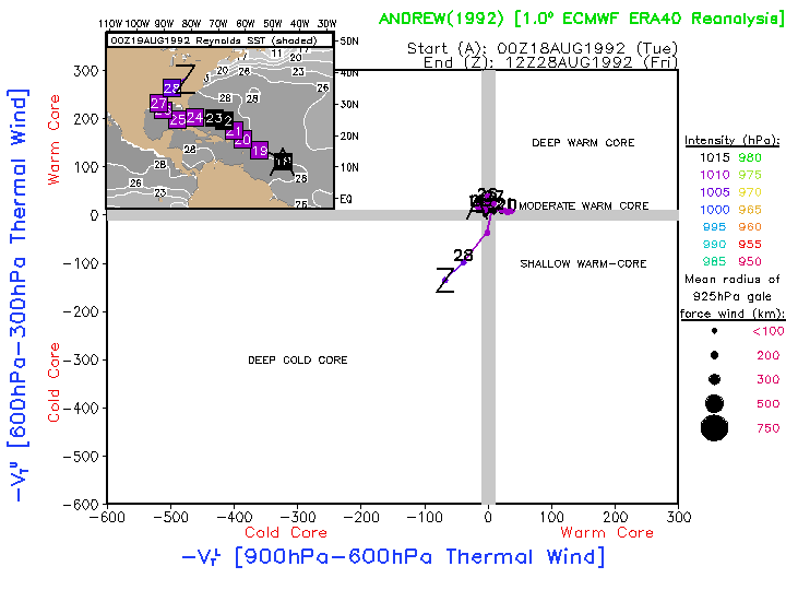
| 1992 | 18-28 August | Hurricane Andrew | North Atlantic | Intense hurricane whos warm core is poorly resolved by the reanalyses, but yet shows a weak extratropical transition just prior to being absorbed. | ERA40: Image Anim | ERA40: Image Anim |
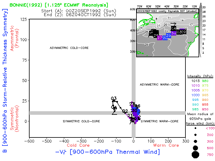
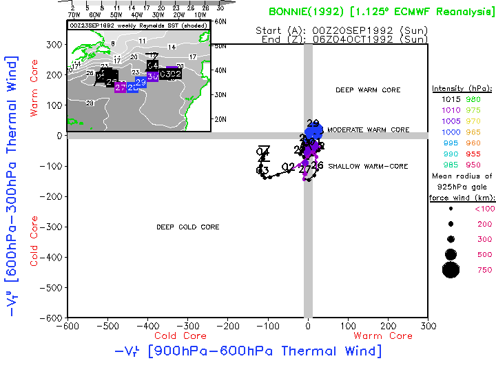
| 1992 | 20 September- 4 October |
Hurricane Bonnie | North Atlantic | . | ECMWF: Image Anim | ECMWF: Image Anim |
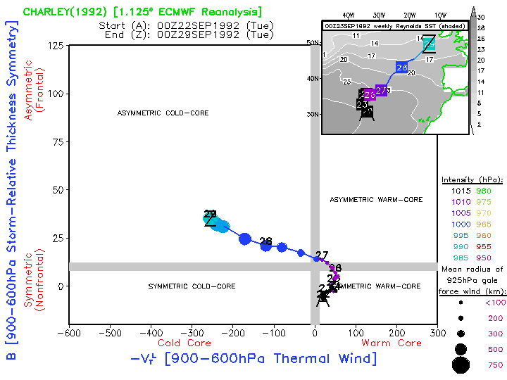
| 1992 | 22-29 September | Hurricane Charley | North Atlantic | . | ECMWF: Image Anim | ECMWF: Image Anim |
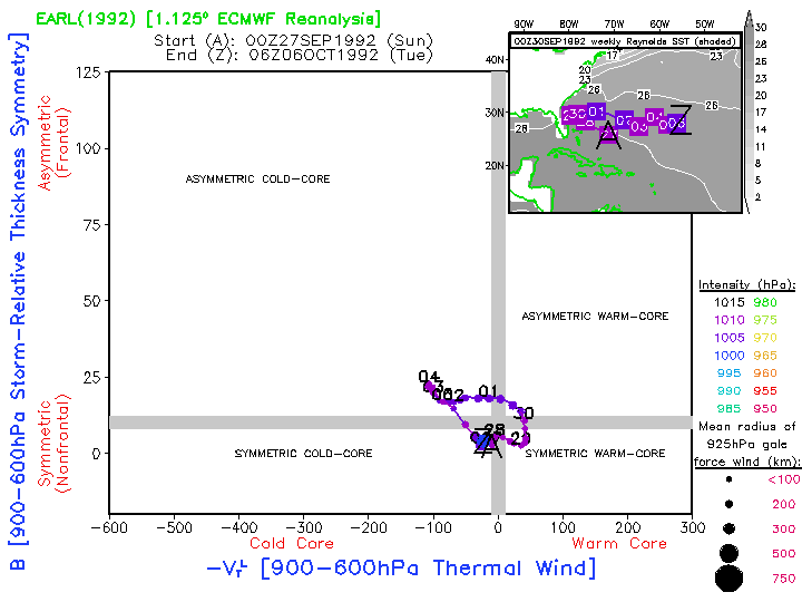
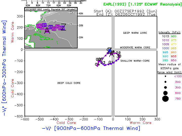
| 1992 | 27 September- 6 October |
Tropical Storm Earl | North Atlantic | . | ECMWF: Image Anim | ECMWF: Image Anim |
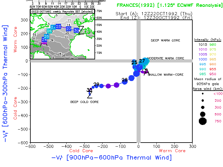
| 1992 | 22-30 October | Hurricane Frances | North Atlantic | . | ECMWF: Image Anim | ECMWF: Image Anim |
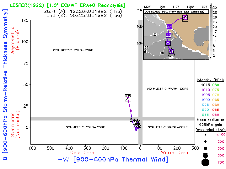
| 1992 | 20-25 August | Hurricane Lester | Eastern Pacific | . | ERA40: Image Anim | ERA40: Image Anim |
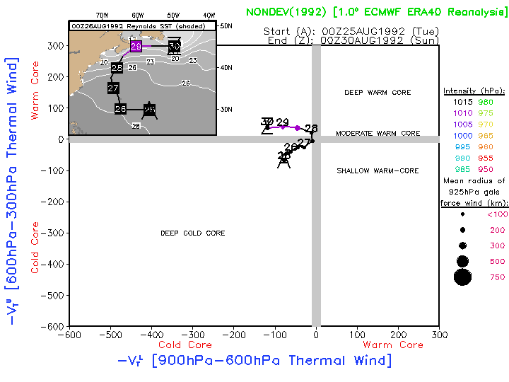
| 1992 | 25-28 August | Nondeveloping | North Atlantic | . | ERA40: Image Anim | ERA40: Image Anim |
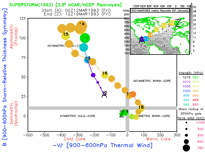
| 1993 | 12-17 March | Superstorm | North America | Extreme baroclinic cyclogenesis that later acquired warm-core characteristics over the northeast Atlantic. | NCAR: Image Anim | NCAR: Image Anim |
| 1993 | 31 August- 6 September |
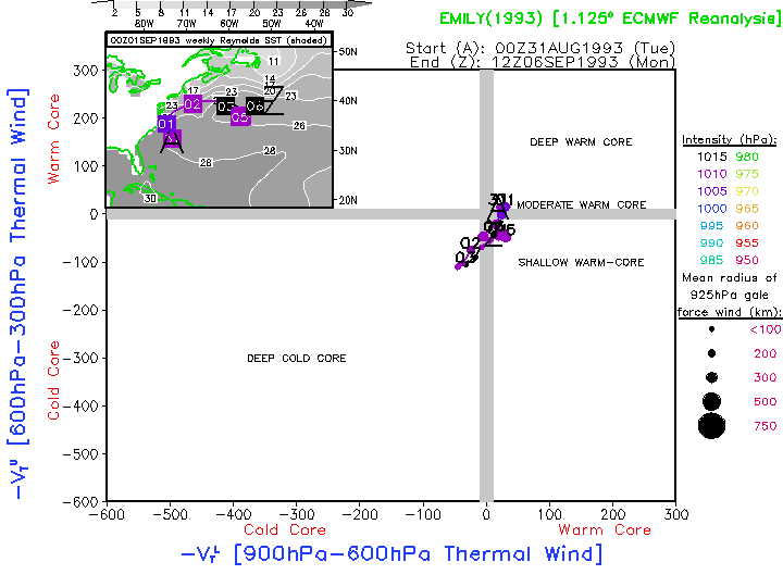
Hurricane Emily | North Atlantic | . | ECMWF: Image Anim | ECMWF: Image Anim |
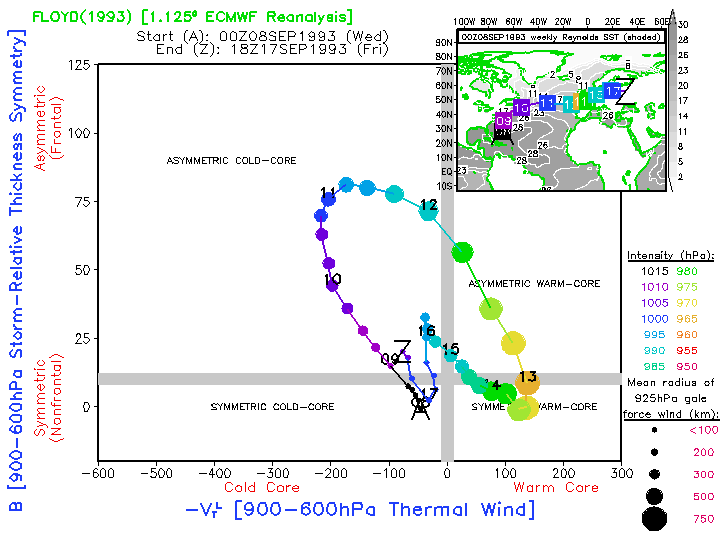
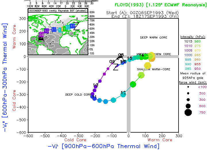
| 1993 | 8-17 September | Hurricane Floyd | North Atlantic | Example of the complete lack of a warm-core tropical cyclone phase within the gridded reanalyses. Illustrates well the need for improved data assimilation methods and/or bogussing methods to improve the warm-core signal within gridded analyses of tropical cyclones. | ECMWF: Image Anim | ECMWF: Image Anim |
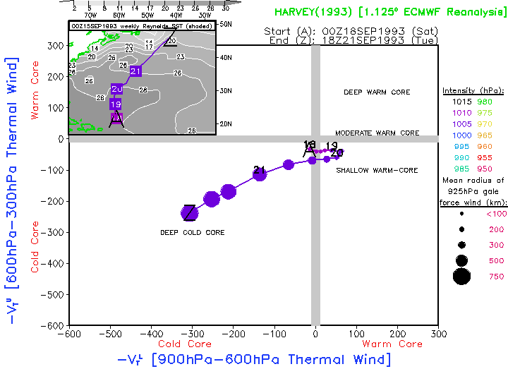
| 1993 | 18-21 September | Hurricane Harvey | North Atlantic | . | ECMWF: Image Anim | ECMWF: Image Anim |
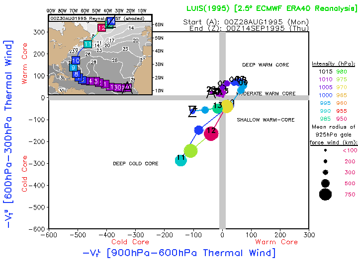
| 1995 | 28 August- 14 September |
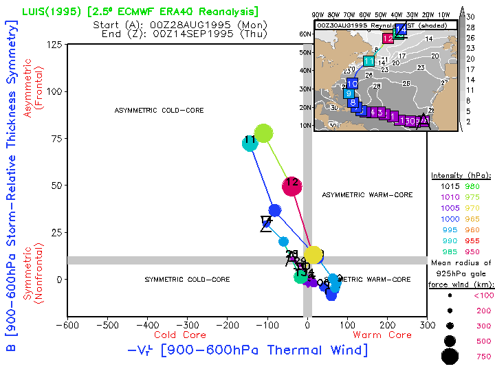
Luis | North Atlantic | . | ERA40: Image Anim | ERA40: Image Anim |